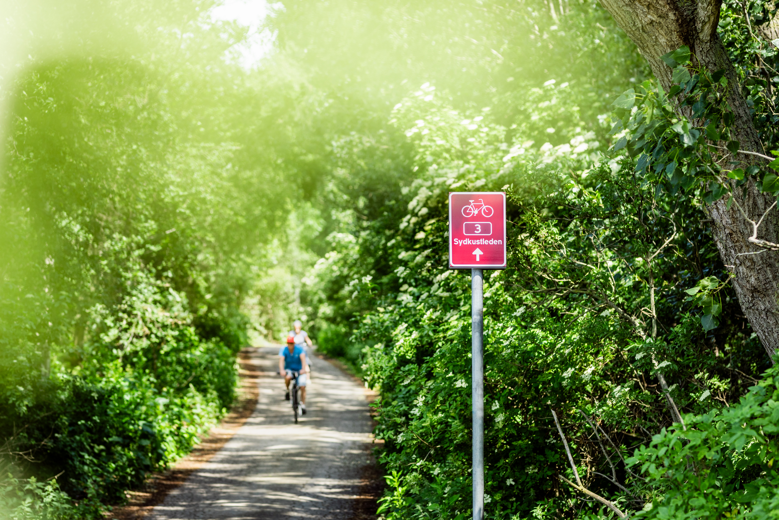
Signage
Sydostleden and Sydkustleden are two of Sweden's nationally classified tourist cycling routes. The certification ensures that the routes are of high quality, safe for traffic, and offer a wide range of experiences and services along the way.
The certification also means that the routes are signposted according to national standards. When you cycle the routes, you can confidently follow the red and white signs marked with a number, regardless of which direction you choose to start from. Sydostleden's signs have the number 2, and Sydkustleden's signs have the number 3. The routes are signposted from both directions – that is, both north to south and south to north.
In some cities, such as Malmö, the signage is integrated with the regular cycle route signs but clearly distinguished with red color.
Surface
Sydkustleden consists mostly of asphalt roads, but approximately 7% of the route has a gravel surface. 66% of the route has its own bicycle path, separated from motorized traffic, which provides a safe feeling, especially when cycling with children.
Sydostleden is an easily accessible cycling route, with some exceptions of more hilly sections. The route mainly consists of asphalted car-free sections, but some stretches may have a gravel or different surface. Sydostleden is relatively flat and easy to cycle. It is 80% asphalted, and 68% of the route consists of a separate bicycle path.
In our map tool, you can see which parts of the route are gravel or asphalt, and whether the road is car-free or runs alongside a road with mixed traffic. You can also discover other attractions worth visiting along the route.
(Note: The translation is provided to the best of my abilities, but it's always a good idea to have a native speaker review important content for accuracy.)
Planned Road Constructions
Hammar - Skillinge
The planned construction of the pedestrian and bicycle path is expected to start in 2025 and will follow the existing main roads 1022 and 1500, aiming to improve the safety for pedestrians and cyclists. It will also enable a more coastal route for the Sydkustleden. The connection will be 22 km long and is estimated to open in 2026. Read more on the website of the Swedish Transport Administration (Trafikverket).
Höllviken – Stavstensudde (Trelleborg)
There are plans to construct a pedestrian and bicycle path along road 511 to enhance the safety for pedestrians and cyclists, while also allowing for a more coastal route for the Sydkustleden. The planned start of construction is in 2024, with completion expected in 2025. Read more on the website of the Swedish Transport Administration (Trafikverket).
Hofterup - Häljarp
Through the urban areas of Hofterup and Ålstorp, the traffic volumes are too high to be considered safe for cycling in mixed traffic along road 1144. Therefore, work has begun to plan for a pedestrian and bicycle path between Hofterup and Häljarp. Once completed, this section will be part of the Sydkustleden.